Hiking and Biking Trails
Whether you prefer a nice walk along a clear rushing stream, a sunset stroll along Lake Chatuge, or a hike up a mountain to a vista that will take your breath away, we’ve got you covered.
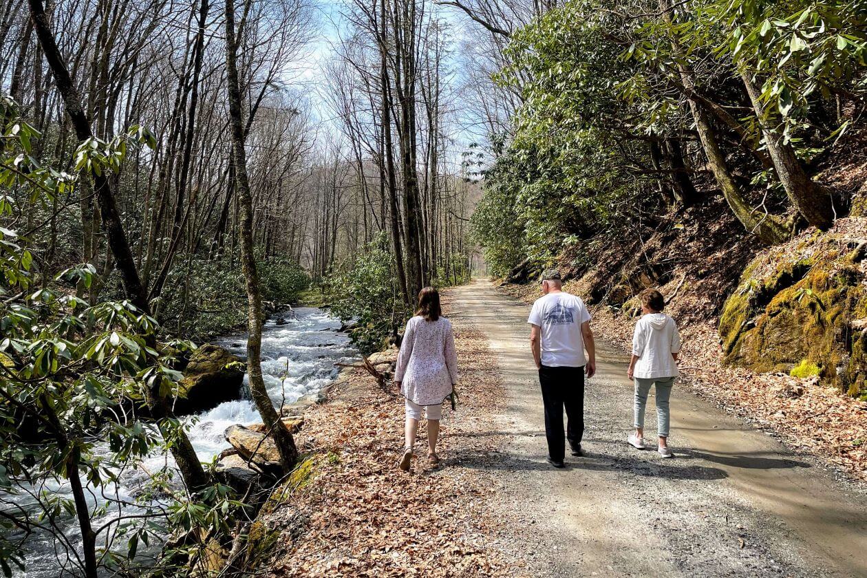
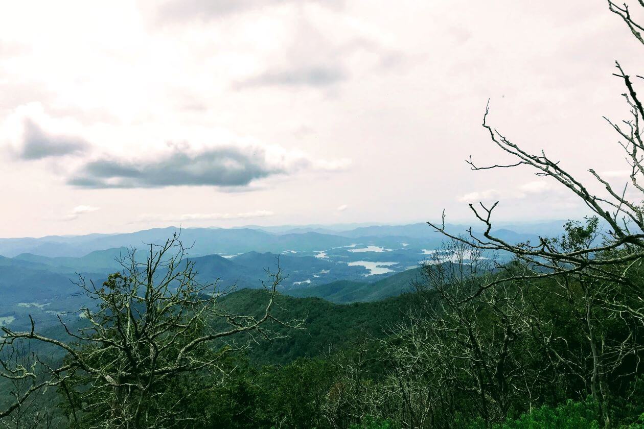
Take a hike in the woods and leave the sounds of the city, the noise and the traffic, the stress of everyday life behind. Here in the forests, hills and mountains surrounding Hayesville and Clay County, we are blessed with miles and miles of uncrowded, unspoiled trails. Pick one and follow it up a mountain, along a rushing stream, beside a flowing waterfall, or high up to a vista that will take your breath away. Trails of all lengths and intensities abound—from a climb along the Appalachian Trail to the top of Siler Bald with breathtaking views of three states to an easy lakefront stroll along the Chatuge Dam trail just outside of town.
Chatuge Dam Trail | Hayesville, NC | Hiking & Biking
An easy paved* three mile path over Chatuge Dam and around the Clay County Campground for hiking or biking. Sunsets over the dam and mountains are gorgeous. Park at Chatuge Dam, which is located by taking Meyers Chapel south from Hwy 64 for .6 miles, then veering left onto Chatuge Dam Rd for 1 mile. You can also access the park off of Meyers Chapel Rd 2.2 miles south of Hwy 64, or 1.6 miles east of Hwy 69. 6 minutes from Hayesville.
Read about the trail on alltrails.com
The Circle | Hayesville, NC | Walking
Across from Chatuge Dam. Easy and paved*. You can walk on the quiet paved road here along the lake. Access this area by taking Hinton Center Rd 1.7 miles south of Hwy 64, then turn right on the Circle (road is not marked but there are two large yellow gates open on the side of the road) for .4 miles.
The Quanassee Path | Hayesville, NC | Walking
Starts at the Cherokee Heritage Site .1 mile south of downtown Hayesville. Easy*. It winds through a native botanical garden, then crosses Old Hwy 64 through a small forest, then crosses Anderson St and goes through the Clay County Park to Spikebuck Mound. Approximately 2 miles round trip.
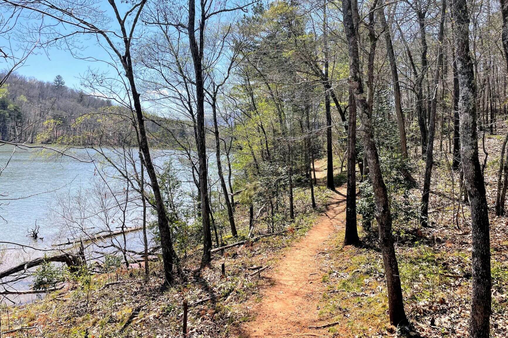
Jackrabbit Mountain Trails | Hayesville, NC | Hiking & Biking
Multiple options for trails, with 3 – 22+ miles of trails in a stacked loop configuration. Easy*. The trails wind along the shores of Lake Chatuge and are popular with hikers and mountain bikers. These trails are accessed from the gravel parking lot .8 miles along Jack Rabbit Rd, off of NC Hwy 175 20 minutes southeast of Hayesville. This is one of the best, free flowing mountain bike trails in GA or NC and is suitable for beginners to advanced riders. A new 6-mile trail with more jumps and bumps just opened closer to the campground.
Read About the trail on alltrails.com
A 2-mile easy Hikers-only trail at Jackrabbit Campground is at the end of Jack Rabbit Rd where the road forks to the left for the campground or right to a boat ramp and large parking lot. It winds around Jackrabbit Mountain and will bring you back to the large gravel parking lot which also has restrooms.
Hikers should be aware that this is primarily a mountain biking trail that also allows hikers. Please be cautious around blind turns and be on the lookout for bikers.
Leatherwood Loop and Fires Creek Trails | Hayesville, NC | Walking & Hiking
Easy paved, or Hard*. There is a one-mile paved trail and picnic area along Fires Creek at beautiful Leatherwood Falls. You can take a .7 mile hike up and around the falls as well.
For seasoned hikers, read about the Fires Creek Rim area offers 25 miles of more challenging trails on alltrails.com.
Leatherwood Falls is 14 minutes west of Hayesville.
Murphy River Walk | Murphy, NC | Walking & Hiking
A 3.4 mile easy* out and back trail along the Hiwassee River near downtown Murphy. 20 minutes west of Hayesville.
Read about the trail on alltrails.com
Lake Chatuge Loop | Hayesville, NC | Walking & Hiking
An easy* one mile loop trail along a peninsula at 440 Sunnyside Rd south of Hiawassee. 13 minutes south of Hayesville.
Read about the trail on alltrails.com
DeSoto Falls Trail | Dahlonega, Georgia | Hiking
A moderate* 1.9-mile trail in Vogel State Park that goes to two waterfalls. 43 minutes south of Hayesville.
Read about the trail on alltrails.com
High Shoals Falls Trail | Hiawassee, Georgia | Hiking
A moderate* 2.6-mile hike south of Hiawassee that features two waterfalls. 32 minutes south of Hayesville.
Read about the trail on alltrails.com
Appalachian Trail Hikes
The Appalachian Trail crosses Hwy 64 23 miles east of Hayesville at Winding Stair Gap. You can read about the hike north to Siler Bald on alltrails.com, on a moderate 9.4-mile round trip…or go north or south as far as you want, and say you’ve hiked the AT!
26 minutes east of Hayesville on Hwy 64.
There are a number of great trails in the Nantahala National Forest about an hour east of Hayesville, many along the Appalachian Trail:
Standing Indian Campground | Franklin, NC | Hiking
Offers several out and back trails from easy to moderate* along the Nantahala River and Kimsey Creek area. Go 20 miles east of Hayesville on Hwy 64 then right on W Old Murphy/Allison Rd to the campground.
Read about some of our favorites on these alltrails.com links: Kimsey Creek, the Campground Trail, and Deep Gap to Standing Indian.
You can also read about the trail at recreation.gov
Deep Gap to Standing Indian Mountain | Franklin, NC | Hiking
This 5-mile round trip, moderately difficult hike along the AT ends in outstanding views.
Read about the trail on ashevilletrails.com
Tellico Gap to Wesser Bald Fire tower | Franklin, NC | Hiking
2.8 miles round trip relatively moderate.
Read about the trail on ashevilletrails.com
Wayah Gap to Siler Bald | Franklin, NC | Hiking
3.6 miles round trip relatively moderate.
Read about the trail on ashevilletrails.com
Albert Mountain Fire Tower | Franklin, NC | Hiking
4 miles round trip more difficult.
Read about the trail on ashevilletrails.com
Click here for a downloadable list of hikes including many on this list plus more.
*All difficulty designations provided are based on those on Alltrails.com and are not made by the Clay County Chamber of Commerce. Please use only as a starting guideline and know that the difficulty of each trail may vary.